.: Belize Overview
Belize (formely known as British Honduras) is a small country about 280km long and 110km wide. Lying on the Caribbean coast of Central America, it has Mexico to the North and Guatemala to the South and West. Belize is a relatively low-lying country with a coastline of small cayes and the second largest coral reef in the world. To the North the country is flat as it extends to join the Yucatan peninsula of Mexico.
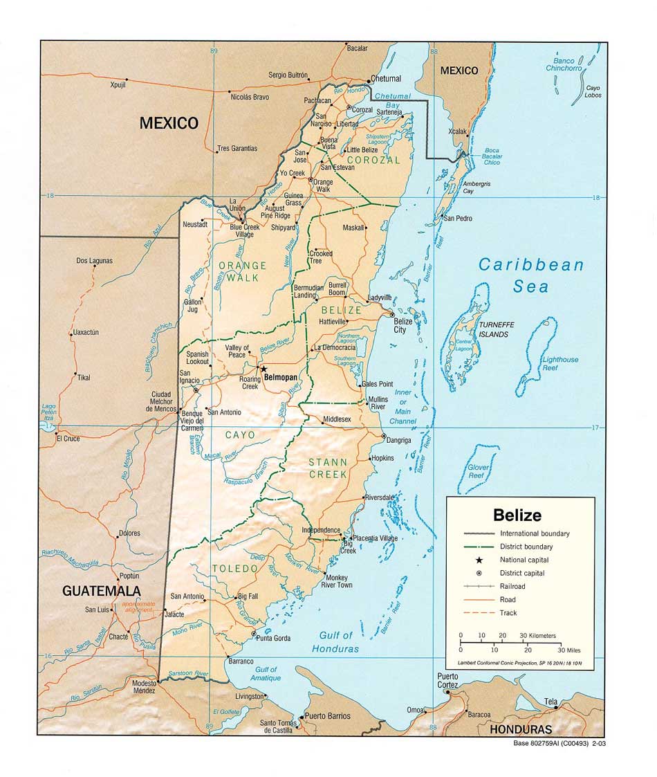
In the centre of the country lies a granite massif, Victoria peak
being the highest point at 1120m, formed before the surrounding
Cretaceous limestone, being responsible for the surrounding
uplift, which has formed the Mayan Mountains where the main cave
development is located.
This mass of limestone along with the large rainfall, which occurs during the wet season, allows for a huge potential for cave development. Unlike the Yucatan peninsula, that has received attention in recent years, the landscape in Belize leaves potential for dry cave development.
.: Permits & Permissions
All cave exploration in Belize falls under the jurisdiction of the
Institute of Archaeology (IA) who control access. This is due to the
significance that caves played in the ancient Maya culture
and the artefacts that maybe encountered within caves.
To prevent theft or remains from being destroyed by ignorance,
permission must be obtained from the IA.
As of 2010 this needs to be initiated well in advance of any expedition planned for Belize. In addition it has now become a requirement for some form of archaeological expertise to be included within the expedition members.
Permission to camp in the jungle and forest reserves must be obtained from the Forestry Department before heading into the jungle areas. There is often a charged levied for this permission.
Belize Institute of Archaeology
Archaeology Museum and Research Centre
Culvert Road, Belmopan, Belize C.A.
Phone: 501-822-2106/822-2227
Fax: 501-822-3345
Website:
www.nichbelize.org
.: History of SWCC Exploration
The geology of Belize means it has been well known as a caving destination. American and Canadian cavers have been active in the country since the ‘50’s and there have been several UK expeditions, including two by Queen Mary College in ’88 and ’89 and one by Mendip Caving Group in ’94.
However, the bulk of caving exploration has been done in the Northern and Central parts of the country with the South (Toledo District) being sporadically explored and largely undocumented. It was for this reason in 2001 that we decided to base ourselves in this part of the country.
SWCC Activity
• 2001 - 3 cavers explored and surveyed several caves, between San Jose and San Pedro Columbia.
• 2002 - 5 cavers returned to area but only had limited success due to effects of Hurricane Iris, which had devastated the area shortly after the 2001 trip.
• 2004 - 2 SWCC members joined 3 other cavers based at the British Army (BATSUB) barracks, exploring several caves across the country.
• 2006 - 7 cavers re-explored and surveyed
Champon Cave, initial exploration of
Pueblo Creek Cave; explored to a log jam with continuing passage beyond.
Lagonita Cave discovered. First attempt to get to Central River sink at Esperanza Camp, an area of large karst features.
• 2008 - 10 Cavers, Pueblo Creek explored to over 3km with ongoing leads. In Tiger Cave the ‘Roaring River’ is passed and explored for 500m with leads ongoing. Esperanza camp reached and various new leads identified.
• 2010 - 9 Cavers, Pueblo Creek pushed to within 400m of Ochochpec cave. 2nd entrance to Tiger Cave discovered and parallel streamway explored.
• 2013 - Tiger Cave extended, with discovery of the Growler. Bladen Nature Reserve recce, So Sil Ha discovered, Yax Ta Ha small extension